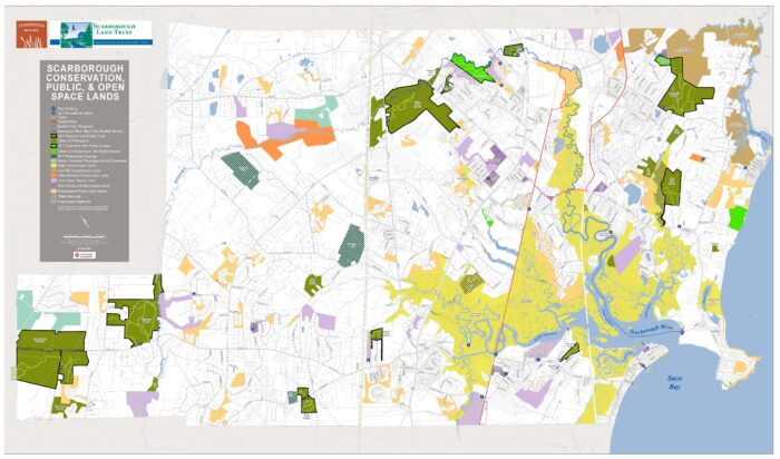
SLT Conserved Lands
SLT Lands with Trails
| YEAR | LAND | ACRES |
| 2019 | Blue Point Preserve | 11 |
| 2004 | Broadturn Farm and Preserve | 434 |
| 2001, 2022 | Fuller Farm Preserve | 219 |
| 2001 | Blue Heron Preserve | 10 |
| 2000 | Hemlock Grove Preserve | 17 |
| 1997 | Libby River Preserve | 90 |
| 2014 | Pleasant Hill Preserve | 161 |
| 1997 | Sewell Woods Preserve | 35 |
| 2012, 2022 | Warren Woods Preserve | 313 |
Other SLT Lands
| YEAR | LAND | ACRES |
| 1995 | Cumberland Way | 9 |
| 1998 | Gorham Road | 9 |
| 1999 | Joss Hill Road | 10 |
| 1987 | Kirkwood Road | 4 |
| 1992 | Old Colony Lane | 20 |
| 1997, 2003 | Pin Tail Point | 26 |
| 2001 | Trapper John | 19 |
SLT Conservation Easements (private land)
| YEAR | LAND | ACRES |
| 2001 | Blue Heron Preserve (with public access trails) | 2.5 |
| 1986, 1988 | Marion Jordan Road | 42 |
| 2000 | Stoney Creek | 6 |
| 2006 | Hunnewell Hill (Town-owned) (with public access trails) | 60 |
| 2014 | Willey Park (Town-owned) (with public access trails) | 13 |
| 2014 | Winslow Homer Studio | 0.5 |
SLT Partnership Projects
| YEAR | LAND | PARTNER | ACRES |
| 2015 | Comstock Farm | Maine Farmland Trust | 99 |
| 2010 | Frith Farm | Maine Farmland Trust | 20 |
| 2008 | Gervais Property | Friends of Scarborough Marsh | 45 |
| 2014 | Jannelle Property | Friends of Scarborough Marsh | 3 |
| 2016 | Waterhouse Farm | Maine Farmland Trust | 100 |


